All-In-One Offline Maps
- Maps & Navigation
- 3.15d
- 7.2 MB
- by Psyberia
- Android 2.1+
- Apr 27,2025
- Package Name: net.psyberia.offlinemaps
OfflineMaps provides you with a comprehensive selection of maps, ensuring you have access to a wide variety of geographic data at your fingertips. With OfflineMaps, you can enjoy a seamless experience free from **advertisements, data sharing & monetization, analytics, and third-party libraries**. Are you tired of waiting for maps to load? With All-In-One OfflineMaps, once the maps are displayed, they are stored and remain accessible quickly, even without an internet connection.
- Looking for more than just road maps? You'll find everything you need right here;
- Do you often visit areas with poor network coverage? Rest assured, all your maps will stay available;
- Traveling abroad? You'll never be lost again;
- Concerned about data limits? OfflineMaps will help reduce your data usage.
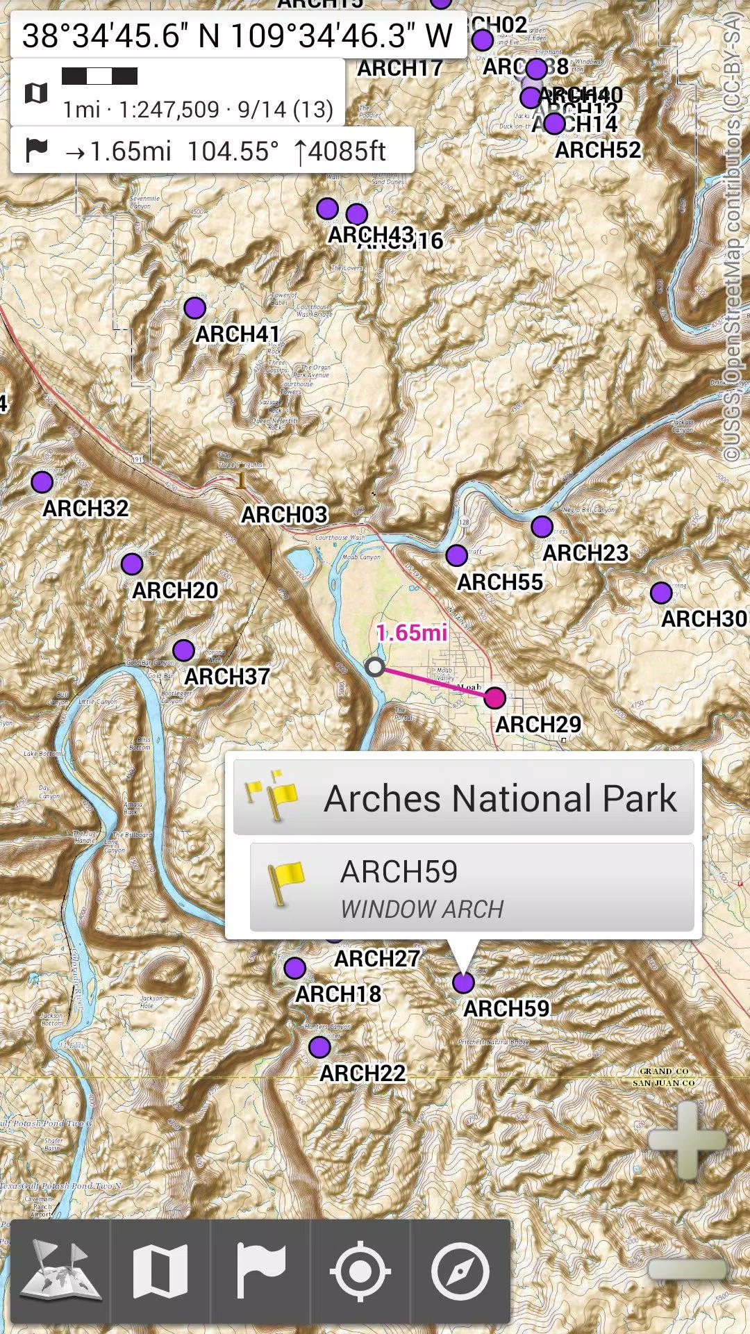
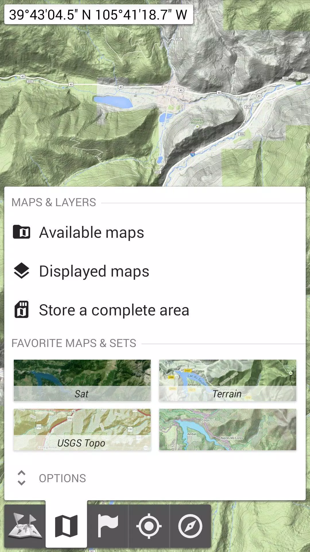
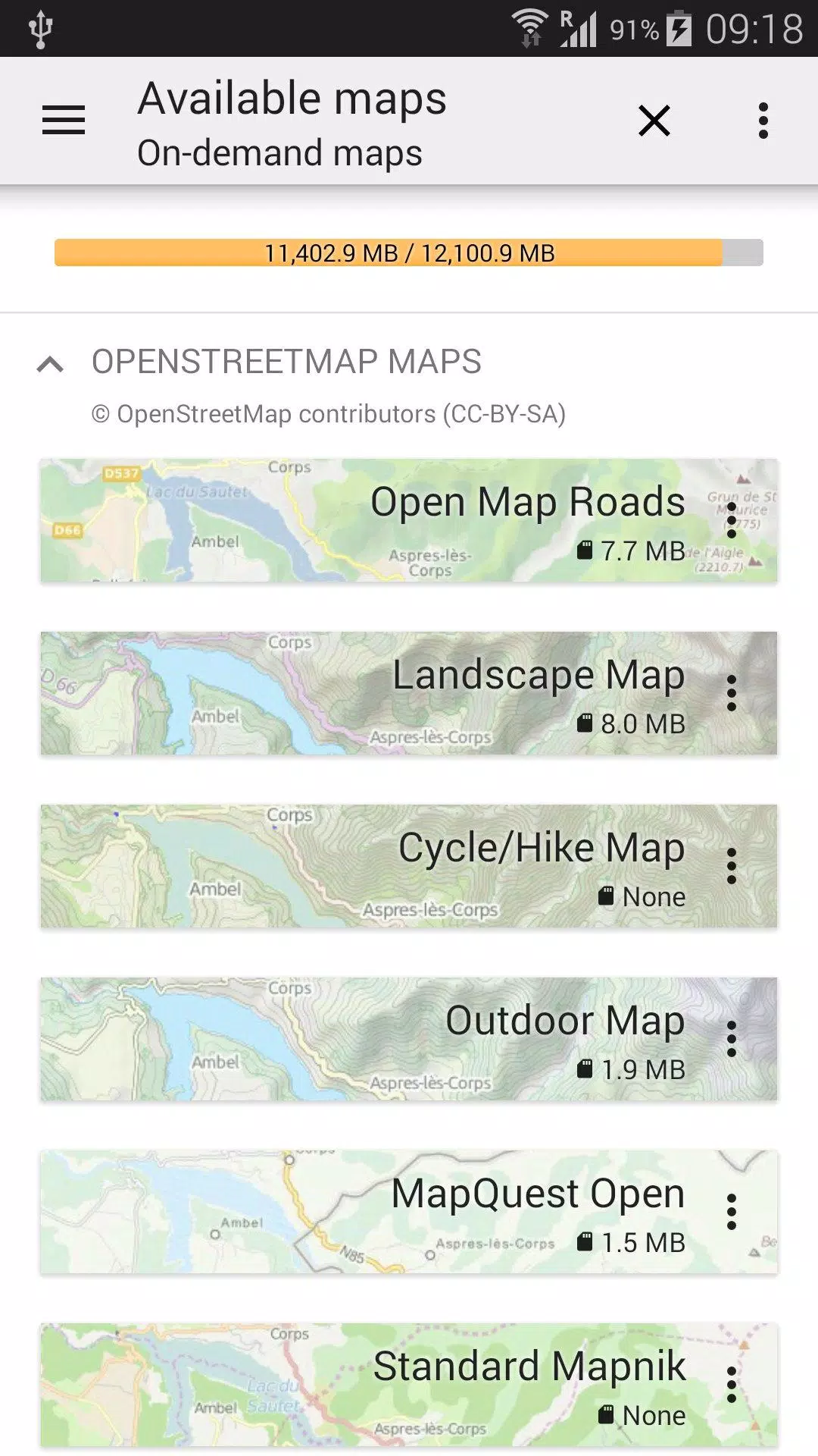
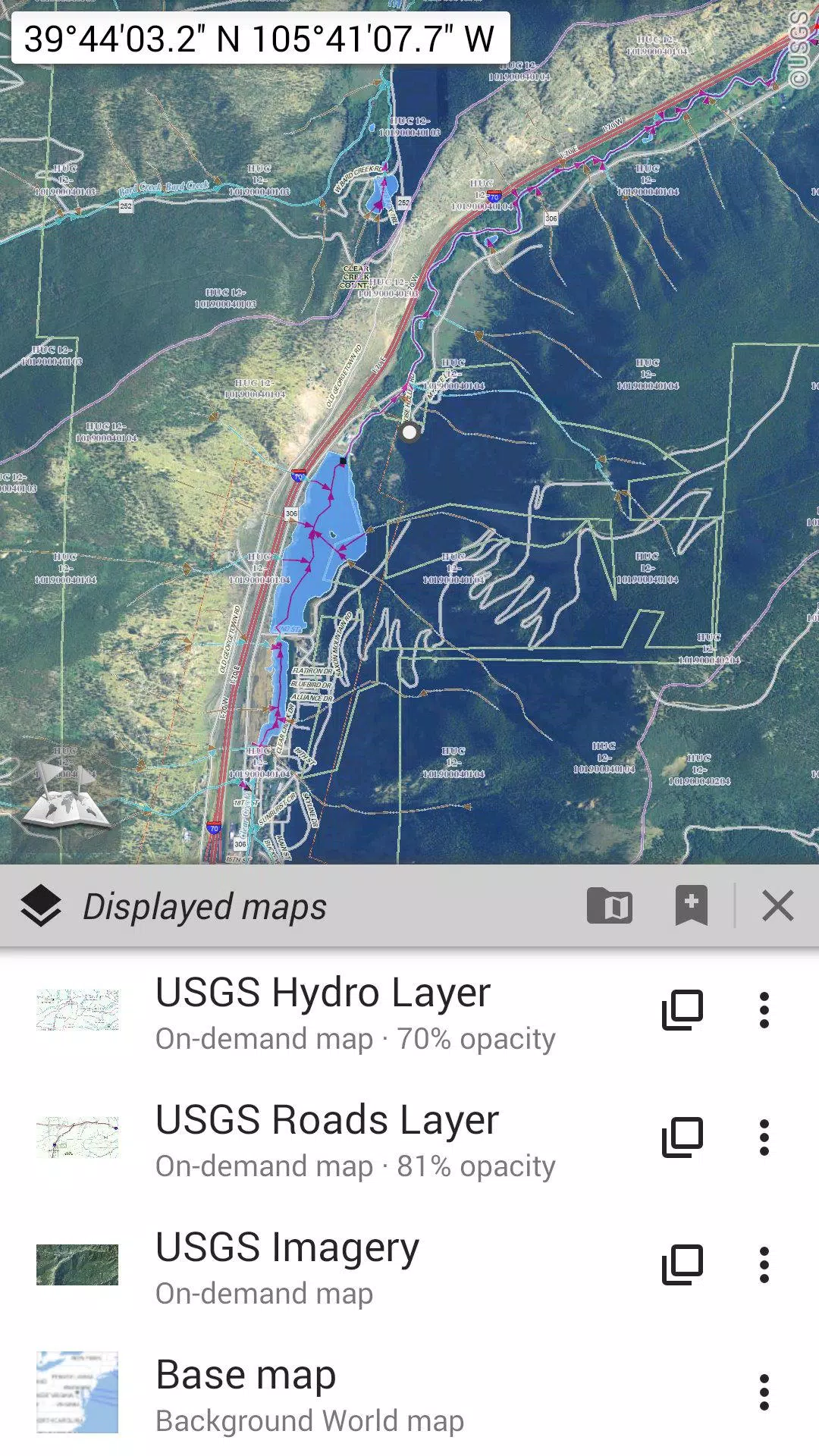
★★ Maps ★★
OfflineMaps offers an extensive collection of maps, including classic road maps, topographic maps, aerial (satellite) maps, and various additional layers that can be superimposed on any map. These include OpenStreetMap (Roads, Topo), USGS National Map (High-resolution topo, Aerial imagery), and Worldwide Military Soviet topo maps, among others.
- All maps can be layered with precise control over opacity;
- Easily select and store large areas with just a few clicks;
- Stored data is organized and can be deleted effortlessly.
★★ Display, Store, and Retrieve Unlimited Placemarks ★★
You have the ability to add numerous items to the map, including waypoints, icons, routes, areas, and tracks. Manage these effortlessly using the robust SD-Card Placemarks Explorer.
★★ On-map GPS Location & Orientation ★★
Your real-time location and direction are clearly shown on the map, which can be rotated to align with your actual orientation (depending on your device's capabilities). Easily toggle this feature on or off to conserve battery life.
Additionally, OfflineMaps supports:
- Metric, imperial, and hybrid distance units;
- GPS Latitude/Longitude and various grid coordinate formats such as UTM, MGRS, USNG, OSGB Grid, Irish Grid, Swiss Grid, Lambert Grids, DFCI Grid, QTH Maidenhead Locator System, and more;
- The ability to import hundreds of coordinate formats from spatialreference.org;
- On-map grid displays;
- Full-screen map view;
- Multi-touch zoom;
- And much more...
★★ Need More? ★★
For the true adventurer, consider trying **AlpineQuest Off-Road Explorer**, the ultimate outdoor solution built on All-In-One OfflineMaps, and equipped with a powerful GPS Track Recorder and more. Learn more at alpinequest.net/google-play.


-
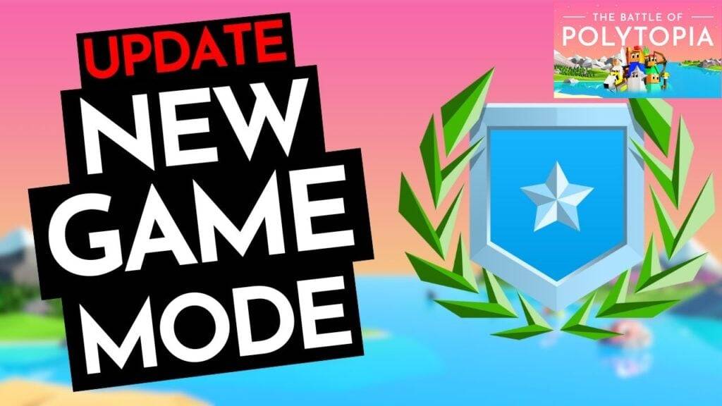 The Battle of Polytopia Brings a New Game Mode Called Weekly Challenges
The Battle of Polytopia has just rolled out an exciting new feature with the introduction of Weekly Challenges, adding a fresh competitive edge to this beloved 4X strategy game. Let's dive into the details and see how this update can elevate your gaming experience.It Was Random BeforeIn the world of
Apr 27,2025 -
 Join Warhammer 40K Space Marine 2 Public Test: Steps Revealed
Since its launch in September 2024, *Warhammer 40K: Space Marine 2* has been bolstered by consistent post-launch support, especially in its online multiplayer modes. If you're eager to dive into new content before it goes live, here's how you can join the *Warhammer 40K: Space Marine 2* public test
Apr 27,2025 - ◇ Supercell Hires for Film and TV: Clash of Clans Movie in the Works? Apr 27,2025
- ◇ SteelSeries Arctis Nova Pro: Best Wireless Gaming Headset Now 25% Off Apr 27,2025
- ◇ "Varenje: Don’t Touch Berries - Shrink to Bug Size, Quest for Normalcy Now in Pre-Registration" Apr 27,2025
- ◇ "Shining Revelry: All Pokemon TCG Pocket Cards Revealed" Apr 27,2025
- ◇ Dragon Soul Tier List: Ultimate Guide Apr 27,2025
- ◇ The Nvidia GeForce RTX 5070 Ti Graphics Card Is in Stock on Amazon (for Prime Members) Apr 27,2025
- ◇ April 2025: Latest Redeem Codes for Black Russia Apr 27,2025
- ◇ Anthony Mackie Confirmed as MCU's Permanent Captain America Apr 27,2025
- ◇ Duskbloods Exclusive Release on Nintendo Switch 2 Apr 27,2025
- ◇ Best Xbox Game Pass Games For Kids (January 2025) Apr 27,2025


- 1 Holiday Thief Arrives in Seekers Notes Dec 26,2024
- 2 Jujutsu Kaisen Phantom Parade: Tier List Update for 2024 Dec 28,2024
- 3 How To Find and Beat the Storm King in LEGO Fortnite Jan 05,2025
- 4 PUBG Mobile's Championship Finale Nears Jan 09,2025
- 5 Goddess Of Victory: Nikke Is Dropping a New Year’s Update and Collabs with Evangelion and Stellar Blade Soon Jan 04,2025
- 6 Blue Archive introduces new story event with the Cyber New Year March Jan 05,2025
- 7 Brok's Festive Adventure Now Available Jan 03,2025
- 8 Skibidi Toilet DMCAs Garry's Mod But Legitimacy Remains Unclear Jan 07,2025


-
Mastering the Art of Digital Tools
A total of 10
-
Hidden Gems: Unexpectedly Useful Other Apps
A total of 10
-
Top Free Adventure Necessary Games for Android
A total of 4